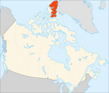
 This page
provides access to images taken during an attempted circumambulation of
the Viking and Ad Astra Ice Caps in Quttinirpaaq
National Park on Ellesmere
Island. Ellesmere is at the far northern extreme of the Canadian
Archipelago. The northern tip of Ellesmere Island is almost, but not
quite, the most
northern point of land on earth. At the northernmost point on our
route, we were within 925km (575 miles) of the north pole. We were
stopped about 30km short of our intended ending point by high water,
necessitating a helicopter evacuation back to the airstrip at Tanquary
Fiord. Ours was not the only trip to encounter high water sufficient to
warrant evacuation. At about the same time, groups on nearby Axel Heiberg Island and on Baffin Island to the south had similar experiences. The cause in all cases was unusual and prolonged high temperatures in the Canadian arctic in the summer of 2011, which results in substantial increases in glacial melting and runoff. Of course, it is important to note that warming temperatures in the polar regions has implications far beyond the inconvenience of a few hiking groups!
- short slide show (5 minutes)
- longer and more complete slide show (13 minutes)
- image gallery
- river crossings (video from Michelle Danielson)
- list of bird sightings (from Terry Skjonsberg)
- .kml file with GPS coordinates, which can be opened in Google Maps or Google Earth (from Jason Nate)
